 has acquired
 Created By: Volunteer JW Boston
95 Marginal St, Boston, MA 02128
Noddle was one of the former Boston Harbor Islands that has disappeared into mainland, particularly into East Boston. Noddle’s Island gained its name from William Noddle, one of the first European occupants of the island. William Noddle lived at Noddle’s Island sometime around 1630. Not much else is known of Noddle as he drowned in 1632. In 1630 settlers had a fort here at Camp Hill called Samuel Maverick’s Garrison (2) with four guns.
The Island had an active presence during the Siege of Boston in the Revolutionary War manning Camp Hill from 1775-1776 with 19 guns on a quadrangular earthwork. In May 1775, colonial forces of 300 known as Provincials, led by General Stark, raided farms on Noddle’s Island and other surrounding islands to block Britain from taking supplies there. A conflict occurred with some British Marines, who drove colonists back to nearby Chelsea Creek.
The British Navy sent marines to pursue the Provincials on foot on Noddle’s Island and also sailed up a narrow tidal waterway called Chelsea Creek on the HMS Diana. A series of land and sea skirmishes occurred involving hundreds of men over two days; both sides fired small cannons and muskets in close proximity in a lethal cat-and-mouse game. The Diana ran aground and the Provincials ransacked and burned it. Casualties on both sides were light but higher on the British side. In the end, the colonial forces denied the British forces the supplies of Noddle’s and Hog Islands. These colonial forces also laid waste to Noddle’s Island and neither side used it for the rest of the siege. Colonial troops returned to several islands a few days later to finish dispersing livestock and destroying supplies. This skirmish that occurred May 27 and 28, 1775 became known as the “Battle of Chelsea Creek.” Like many Revolutionary War confrontations, Americans did not recognize its significance until after the 1820s
After the outbreak of the War of 1812, Noddle’s Island became heavily fortified with an earthwork fort that became known as Fort Strong (1) from 1814-1815. This was near the east end of Webster St at Brophy Memorial park but there’s no remains left. Noddle’s Island later became outfitted with barracks to serve as a hospital by the French Marines in 1780. These barracks remained in place until 1833. (Fort Strong (2) was on Long Island. Boston has a confusing history of moving and reusing fort names)
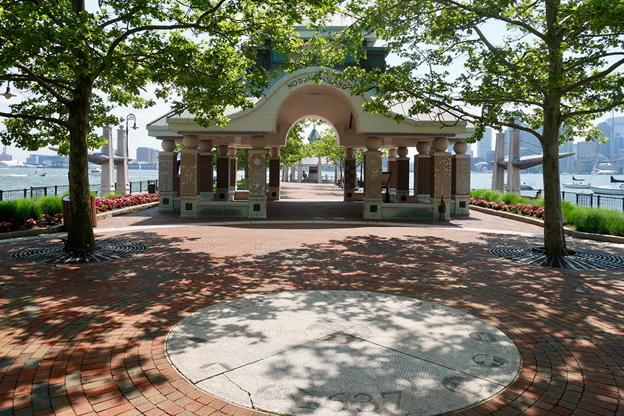
Under the main Pavilion on the Pier – where the map is pinned - is a plaque dedicated to each of the cultures that made up East Boston’s founding. On one of them is, by chance, Jehovah’s four cardinal attributes.
-Source Links-
https://www.nps.gov/places/noddle-s-island.htm
https://www.nps.gov/places/chelsea-creek.htm
https://www.bostonmagazine.com/wp-content/uploads/sites/2/2019/11/east-boston-feature.jpg
https://www.northamericanforts.com/East/maboston1.html
This point of interest is part of the tour: Boston and The Dual-Powered King of the South


Please send change requests to changerequest@pocketsights.com.